

Boundary Surveys: How Cadastral Surveyors Protect Your Property Lines
In the realm of property ownership, clarity regarding boundaries is paramount. Boundary surveys, conducted by skilled cadastral surveyors, play a crucial role in defining and protecting property lines. These surveys not only establish the limits of a property but also help prevent disputes between neighbours and ensure compliance with local regulations. This article delves into the intricacies of boundary surveys, their importance, and how cadastral surveyors safeguard property rights.
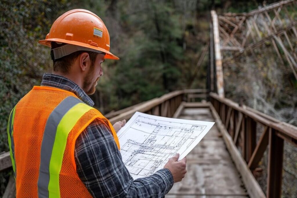
The Role of Cadastral Surveyors
Cadastral surveyors are professionals trained in the art and science of measuring land and establishing property boundaries. Their expertise is essential in a variety of contexts, from residential land development to large-scale commercial projects. These surveyors utilise advanced technology and methodologies to provide accurate and reliable measurements that are legally recognised.
Understanding Cadastral Surveys
A cadastral survey specifically focuses on the boundaries of land parcels. It involves detailed measurements, mapping, and documentation to create a legal description of the property. This process is vital for several reasons:
- Legal Protection: A cadastral survey provides the legal foundation for property ownership, ensuring that the boundaries are clearly defined and recognised by law.
- Dispute Resolution: In cases of boundary disputes, a cadastral survey can serve as a decisive reference point, helping to resolve conflicts between neighbours.
- Development Planning: For new developments, understanding the exact boundaries is crucial for compliance with zoning laws and regulations.
Technological Advancements in Surveying
The field of surveying has evolved significantly with the advent of modern technology. Cadastral surveyors now employ tools such as GPS, drones, and sophisticated software to enhance accuracy and efficiency. These advancements allow for:
- Higher Precision: GPS technology provides precise location data, reducing the margin for error in boundary definitions.
- Faster Surveys: Drones can cover large areas quickly, enabling surveyors to gather data that would take much longer using traditional methods.
- Comprehensive Mapping: Advanced software allows for the creation of detailed maps that visually represent property boundaries and features.
Moreover, the integration of Geographic Information Systems (GIS) has transformed the way cadastral surveyors analyse and interpret land data. GIS technology enables surveyors to layer various information, such as topography, land use, and environmental features, onto a single map. This holistic view not only aids in better decision-making for land development but also assists in urban planning and environmental conservation efforts. The ability to visualise complex data sets in an accessible format has made it easier for stakeholders, including government agencies and private developers, to understand the implications of land use and ownership.
In addition to these technological advancements, the role of cadastral surveyors is increasingly influenced by the need for sustainability. As urban areas expand and the demand for land increases, surveyors are tasked with ensuring that land use is efficient and environmentally responsible. This involves not only accurate boundary delineation but also consideration of ecological impacts, which can lead to more sustainable development practices. By collaborating with environmental scientists and urban planners, cadastral surveyors contribute to the creation of spaces that balance human needs with the preservation of natural resources.
The Importance of Boundary Surveys
Boundary surveys are not merely a formality; they are essential for various reasons that impact property owners directly. Understanding these reasons can help property owners appreciate the value of investing in a boundary survey.
Preventing Disputes
One of the primary benefits of conducting a boundary survey is the prevention of disputes between neighbours. Property lines can often be ambiguous, leading to misunderstandings and conflicts. A clear, professionally conducted survey delineates boundaries, providing a reference point that can help avoid disagreements. In the event of a dispute, having a legally recognised survey can be invaluable.
Enhancing Property Value
For property owners, knowing the exact boundaries can enhance the value of their land. A clear boundary definition can make a property more attractive to potential buyers, as it eliminates uncertainty regarding land ownership. Furthermore, accurate surveys can identify any encroachments or easements that may affect the property’s value, allowing owners to address these issues proactively.

Compliance with Regulations
In Australia, various local and state regulations govern land use and development. A boundary survey is often a prerequisite for obtaining permits for construction or renovations. By ensuring compliance with these regulations, property owners can avoid costly fines and delays in their projects. Additionally, a survey can help identify any zoning restrictions that may apply to the property.
The Boundary Survey Process
The process of conducting a boundary survey involves several key steps, each designed to ensure accuracy and reliability. Understanding this process can demystify the work of cadastral surveyors and highlight the importance of their role.
Initial Consultation
The first step in the boundary survey process is an initial consultation between the property owner and the cadastral surveyor. During this meeting, the surveyor will discuss the property’s history, any previous surveys, and the specific needs of the owner. This information is crucial for planning the survey effectively.
Field Work
Once the initial consultation is complete, the surveyor will conduct fieldwork. This involves physically visiting the property to take measurements and gather data. Using tools such as total stations and GPS, the surveyor will establish reference points and measure distances. This stage is critical for ensuring that the survey is accurate and reflects the true boundaries of the property.
Data Analysis and Reporting
After collecting the necessary data, the surveyor will analyse the information and create a detailed report. This report typically includes a legal description of the property, a map showing the boundaries, and any relevant notes regarding encroachments or easements. The final report is a vital document that property owners can use for legal purposes or future transactions.
Legal Implications of Boundary Surveys
Boundary surveys carry significant legal implications, making them an essential component of property ownership. Understanding these implications can help property owners navigate potential challenges and protect their interests.
Title Insurance and Boundary Surveys
When purchasing property, many buyers opt for title insurance to protect against potential disputes over ownership. A boundary survey can complement title insurance by providing a clear understanding of property lines. In the event of a claim, having a professionally conducted survey can strengthen the buyer’s position and help resolve issues more efficiently.
Dispute Resolution in Court
In cases where disputes escalate to legal proceedings, a boundary survey can serve as critical evidence. Courts often rely on the findings of a qualified cadastral surveyor to make determinations regarding property lines. Having a comprehensive survey report can significantly influence the outcome of a dispute, making it an invaluable asset for property owners.
Updating Property Records
Boundary surveys also play a role in updating property records with local authorities. Accurate records are essential for maintaining the integrity of land ownership and ensuring that property taxes are assessed correctly. By providing updated survey information, property owners can help prevent future disputes and ensure compliance with local regulations.
Selecting a qualified cadastral surveyor is crucial for obtaining an accurate and reliable boundary survey. Property owners should consider several factors when choosing a surveyor to ensure they receive the best possible service.
Qualifications and Experience
When evaluating potential surveyors, it is essential to consider their qualifications and experience. Look for surveyors who are licensed and have a strong track record in conducting boundary surveys. Experience in the local area can also be beneficial, as local surveyors will be familiar with regional regulations and common boundary issues. Click here to get why construction surveyors are essential for successful builds.
Reputation and Reviews
Researching a surveyor’s reputation can provide valuable insights into their reliability and professionalism. Reading reviews from previous clients can help gauge the quality of service provided. Additionally, seeking recommendations from friends, family, or real estate professionals can lead to finding a reputable surveyor.
Cost and Services Offered
Cost is often a significant factor when choosing a cadastral surveyor. While it is important to consider the price, it should not be the sole determining factor. Property owners should seek a balance between cost and the quality of services offered. It is advisable to request quotes from multiple surveyors and compare their services to ensure the best value for money.
Conclusion
Boundary surveys are an essential aspect of property ownership, providing clarity and legal protection for property lines. Cadastral surveyors play a vital role in this process, utilising advanced technology and expertise to deliver accurate and reliable surveys. By understanding the importance of boundary surveys and the role of cadastral surveyors, property owners can make informed decisions that protect their investments and prevent disputes.
Investing in a boundary survey is not just a precaution; it is a proactive step towards securing property rights and ensuring compliance with local regulations. For anyone considering a property purchase or development, engaging a qualified cadastral surveyor is a wise decision that can yield significant long-term benefits.